
Panoramic Video
Panoramic Video
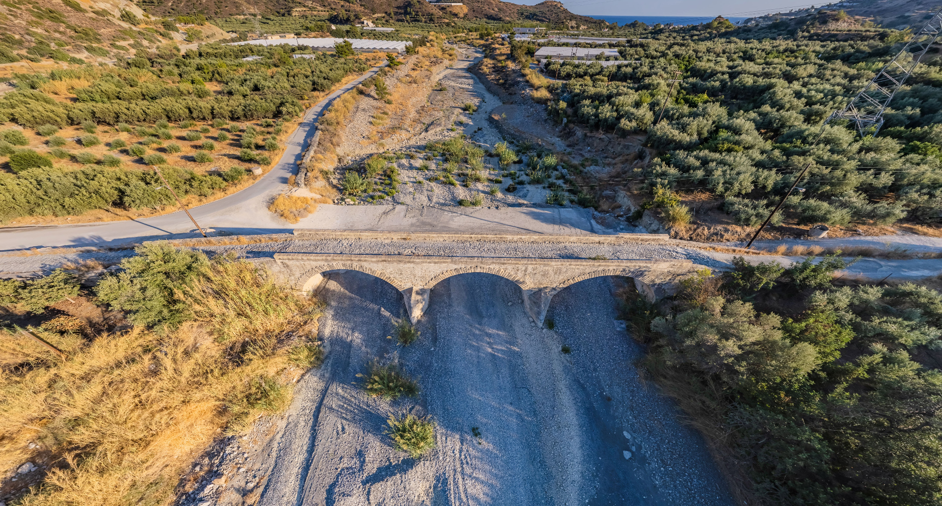
The Bridge of Kryopotamos is located in the area of Ierapetra, near the village of Myrtos. This stone bridge is an important historical landmark of the area and is often referred to as the Bridge of Myrtos. It was built in 1884, as evidenced by the inscription on its inner side.
It is a large bridge, with a total length of 73.50 metres and a width of 4.05 metres. On the upper surface of the bridge, an old cobbled street is preserved. The bridge consists of three large arches, which were constructed from carved rectangular stones protruding at the corners.
The purpose of the construction was to facilitate travel and to provide a safe crossing point for the residents of the area who wanted to cross the river. The location of the bridge near Myrtos makes it easily accessible for visitors wishing to explore this historic architectural structure and admire the excellent knowledge and aesthetic perception of the builders of the past. In fact, it has been classified as a work of art.
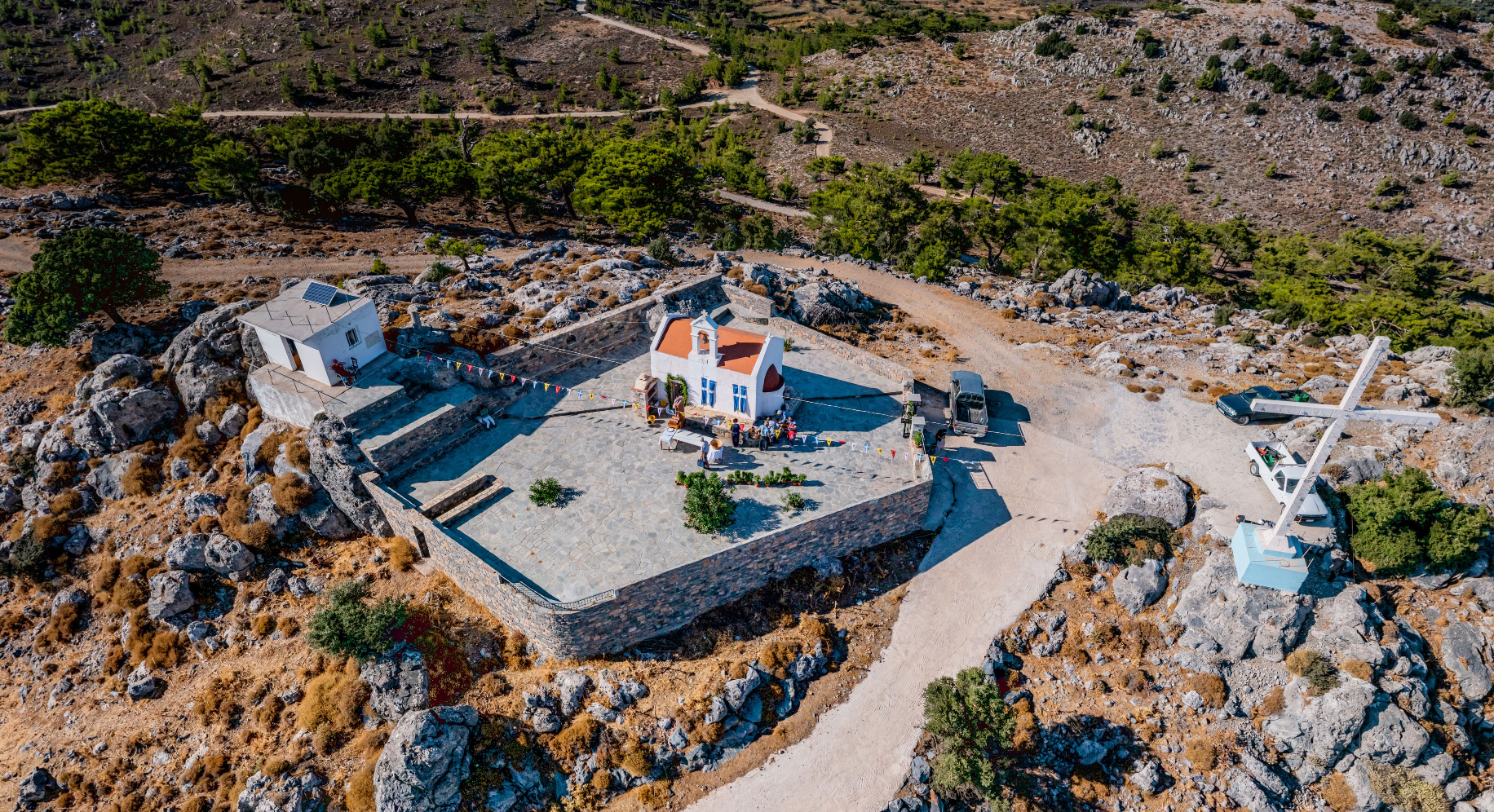
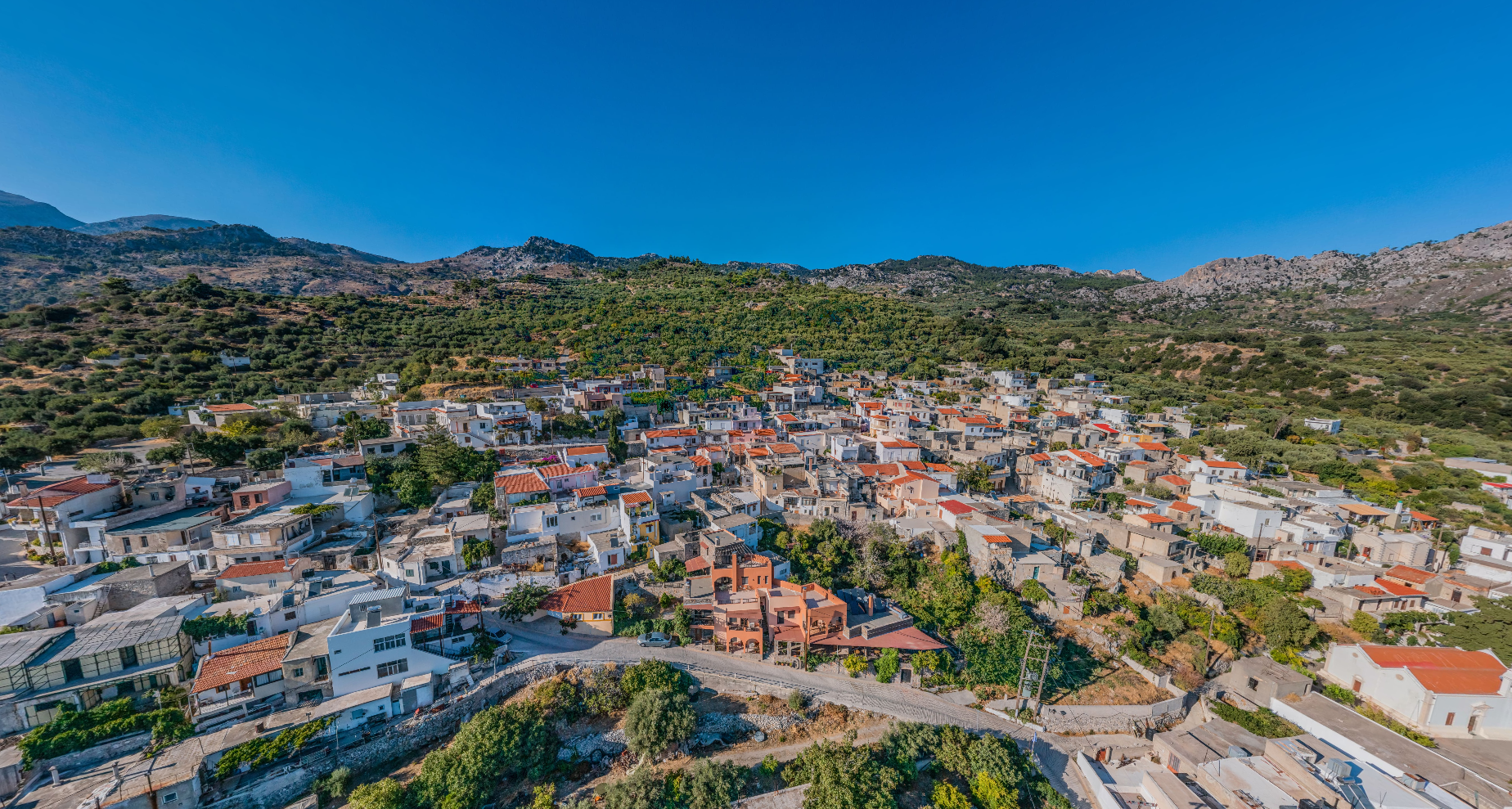
Perched on the slope of the rocky Stavromenou hill and at an altitude of 600 m, is the settlement of Anatoli Lasithiou. It is 17 km northwest of Ierapetra and is characterized by stone houses, narrow streets and traditional Cretan architecture.
At the top of the hill of Stavromenos Anatoli there is a large cross next to the church of Stavromenos. Its position offers a panoramic view, north to the Cretan and south to the Libyan sea. On the hill of Stavromenou Anatoli, an important Summit Sanctuary was founded during the Minoan period.
Its fortified position offers a panoramic view, north to the Cretan Sea, south to the Libyan Sea, as well as to the Minoan building in Gaidourofa.
The existence of a hilltop sanctuary was part of the habit of people to practice public worship on high peaks during the Middle Minoan period (2100-1700 BC).
With the aim of unifying the public space of the centre of Ierapetra, a project for the regeneration of the Central Square of Ierapetra was carried out. The project included paving of Kothri Street up to Kanupaki Square with removal of the existing pavements and paving with paving stones, cobblestones and artificial stone slabs. Part of the project included actions such as blind paths, new wiring, municipal lighting masts and a stormwater drainage system. Regularly spaced flower beds were created where new trees were planted and benches were constructed of exposed concrete. The area between the old town hall of Ierapetra and the police building was also redeveloped. An open-air exhibition and display area for marble constructions, a new small theatre, a vehicle exit route from the coastal parking area and the police station, new plantings and the end of the cycle path on Republic Street where benches were constructed.
In a second phase, the Municipality of Ierapetra has taken the necessary steps to launch a second project of developmental character, entitled "Open Mall of the Municipality of Ierapetra". The new project is part of the functional and aesthetic upgrade of the city, with the ultimate aim of increasing commercial traffic and stimulating local entrepreneurship.
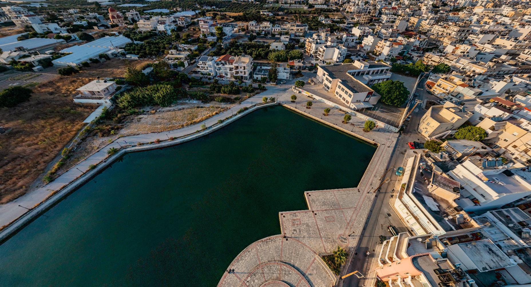
The Battleground is a Roman sea theatre, which was inspired by Julius Caesar in 46 BC. Ships would enter the enclosed harbour through the narrow channel and perform bloody naval battles to the delight of the spectators who watched them sitting on the land part of the lake. Just as in the Roman arenas, the sea battles involved prisoners and slaves of the Roman Empire.
Within walking distance from the artificial lake "Naumachia", at the southwestern end of the city, is the Ierapetra Traffic Education Park. It is aimed at children of pre-school and school age with the aim of raising their awareness on road safety and proper road behaviour. In particular, children have the opportunity to learn in a fun, experiential way about road traffic signs, how to behave as pedestrians, drivers or cyclists and passengers.
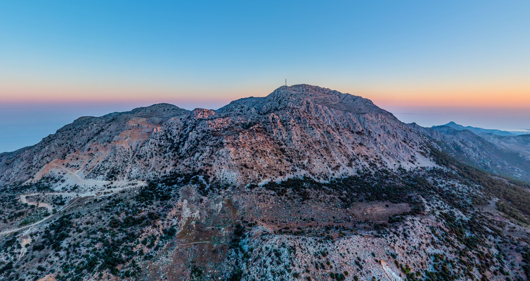
The settlement of Thripti is located 16km from Ierapetra and is built at an altitude of 860 meters at the top of Mount Thripti. The village is an ideal destination for those seeking a peaceful retreat in nature. The settlement is mainly inhabited during the summer months, while the few permanent residents are engaged in the cultivation of vineyards and livestock farming. Traditional houses and a picturesque tavern welcome visitors who want to get a taste of the local Cretan cuisine.
Thripti is the starting point for scattered hiking trails, through which nature lovers can explore the surrounding mountains (the "Aori", as they are called by the locals), the impressive Gorge of Ha as well as climb to an altitude of 1476 meters to reach the highest peak of the mountain range. There is the Church of the Master of Christ, which gives visitors a panoramic view of the surrounding area. The Dodecanese Sea, Kasos, the Libyan Sea and the provinces of Ierapetra and Sitia stretch out before anyone who attempts to climb the mountain.
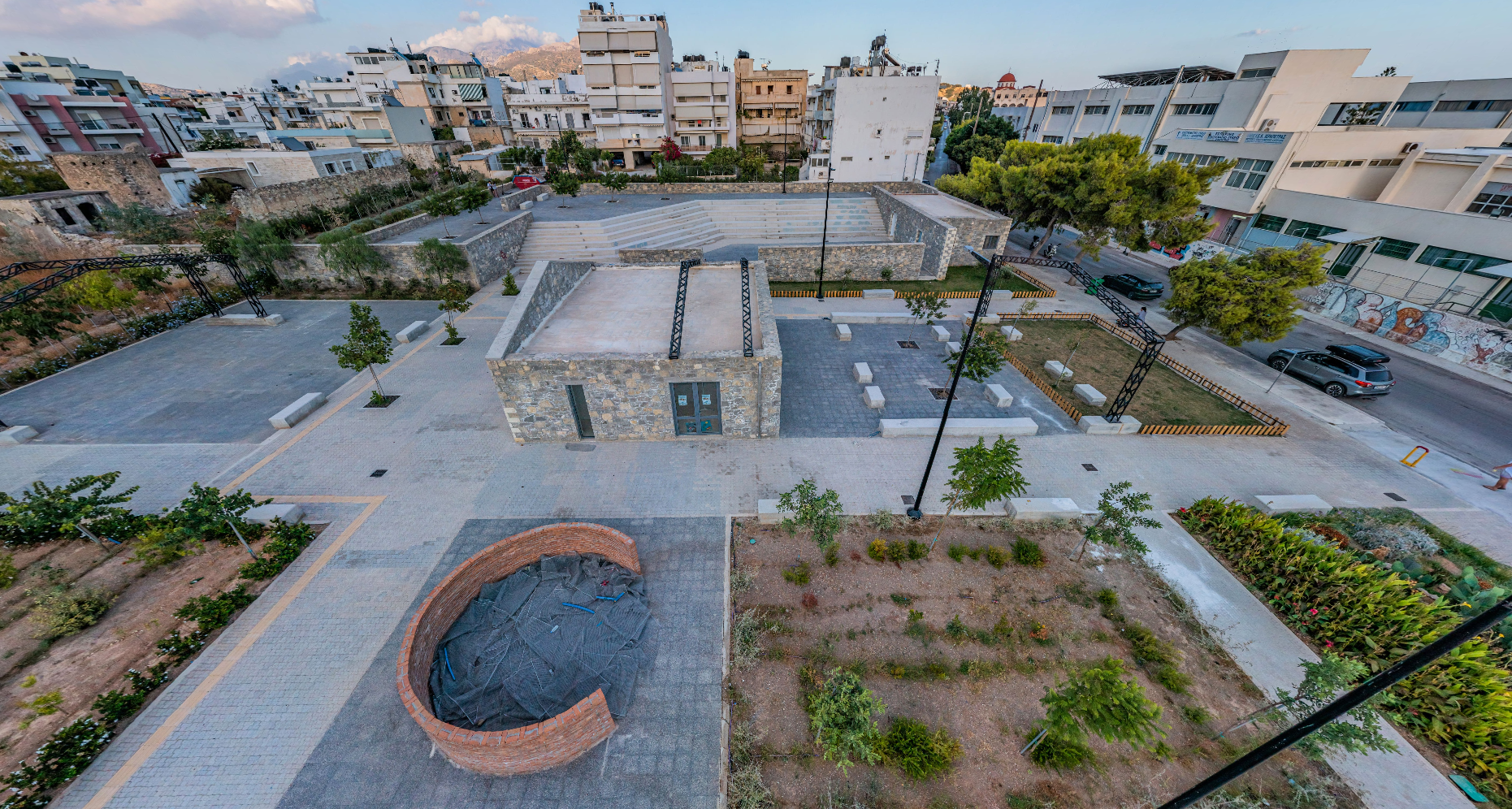
On the eastern side of Ierapetra, in the area of the historical factory "Minos", the new park of exhibition and cultural activities of the city is located. This is a redevelopment project, the design of which won a prize at the Best City awards 2016. This historic site came into the ownership of the Municipality of Ierapetra following an acquisition in the early 2000s. The new project achieved its goal of transforming the previously underutilized area into a development attraction and cultural space.
The "Minos" olive oil-soap processing factory started its operation after the period of the German Occupation, at the beginning of the 20thth century. For many years, its towering chimney was a landmark for the town of Ierapetra, until the demolition of the historic building in 1980 for safety reasons. Thanks to the redevelopment project, visitors can take a closer look at the monument that has been erected in place of the 'legendary' chimney.
The new multi-purpose hall includes five open exhibition spaces, which refer to the main factory buildings. Specifically, outdoor event spaces, green spaces, an open amphitheater, refreshment stand and public toilets have been constructed. At the entrance to the park one can read information about the history of the factory, as well as its pivotal role in the economic and social life of Ierapetra.
The establishment of the Archaeological Collection began in the late 19th century by archaeology enthusiasts from Ierapetra. After enduring destruction and looting up to World War II and undergoing multiple relocations, the Collection was housed in 1986 in the Ottoman School building, also known as "Mehtepi," where it remains today.
The building, constructed in 1899, is designated as a modern historical monument. Its floor plan is an elongated rectangle with three nearly square sections protruding at each end and the center, where the three entrances are located. Architecturally, it features simple neoclassical elements combined with eclectic details, such as the decoration of the central entrance, Venetian-inspired motifs, and the stone cordone—a semicircular molding—that crowns the buttressed façade base.
The Collection has been enriched with objects from later discoveries and excavations conducted by the Ephorate of Antiquities, the British School at Athens, and the American School of Classical Studies at Athens in Ierapetra and its broader region. The exhibits span from the Minoan to the Roman period (3100 BC–324 AD).
In the first of the three halls, the exhibits date from 3000 BC to 324 AD, reflecting various aspects of life, including daily activities, religion, and death. From the settlement of Fournou Korifi at Myrtos, dating to the Early Minoan II period (2600–2200 BC), notable vessels and early pottery wheels are displayed. From the islet of Chrysi, two treasures uncovered in recent excavations are exhibited: the treasure of bronze talents and the treasure of jewelry. Other items from various areas in the Ierapetra province include stone vessels, tools, lamps, and a well-preserved stone mold for casting bronze axes.
From the settlement of the Late Minoan IIIC period (1200–1100 BC) at Vrontas, near the modern village of Kavousi, two impressive clay figurines of the Minoan "goddess with raised arms," a deity of nature, stand out alongside ritual vessels found in the settlement's sanctuary. Few figurines and plaques represent the Archaic period of Ierapetra, while rare and intriguing for the area are the Attic red-figure vases of the 5th and 4th centuries BC. Roman-period ceramics (1st–5th century AD) are mainly represented by lamps, small amphorae, and perfume containers.
The second hall focuses on burial customs from the Late Bronze Age and the Iron Age. Key exhibits include larnakes (clay coffins) from chamber tombs of the Late Minoan III period (1440–1050 BC) found in Episkopi, Gra Lygia, and Kentri. The famous larnax from Episkopi stands out, adorned with depictions of animals, hunting scenes, chariots, and other imagery. From the Iron Age, a tomb reconstruction from Vrontas Kavousi with cremations is notable.
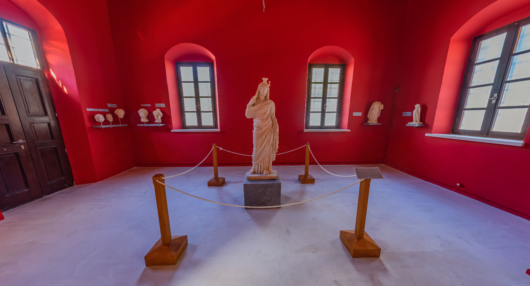
In the third hall, sculptures that adorned public and private buildings of the city during the Imperial Roman era are displayed. Dominating the space is an exceptional-quality and well-preserved statue of Demeter or Persephone from the 2nd century AD. The most significant sculptures, found in the Vigla area—the center of ancient Hierapytna—include a portrait of Emperor Augustus (27 BC–14 AD), a headless statue of Artemis, a statue of a Nereid on a dolphin, and a headless female statue from the city's ancient theater. The Roman sculpture collection is completed with inscriptions and funerary steles from the Hellenistic and Roman periods. Among these, a notable artifact is the bilingual stele featuring the treaty of the Hierapytnian people with King Antigonus Doson of Macedonia and their agreement of equal rights with the Arcadians (3rd century BC).
Information on Ancient Hierapytna (Ierapetra)
The ancient coastal city of Hierapytna is partly overlapped by the modern city of Ierapetra. Ancient sources preserve other names for the city, such as Kyrva, Pytna, Kamiras, and Hierapolis.
The earliest finds in the area date back to the 5th century BC. By the 3rd century BC, Hierapytna formed treaties and alliances with other Cretan cities and external powers like Rhodes, Macedonia, and Pergamon. By the mid-2nd century BC, it expanded its territory, conquering and destroying Praisos around 145 BC. Land disputes with Itanos led to prolonged legal battles over the sanctuary of Dictaean Zeus and the islet of Leuke (modern Koufonisi), eventually involving the Romans as arbitrators. During the Hellenistic period, its strategic location established it as a significant local power.
Hierapytna, the last bastion of Cretan resistance against the Romans, fell in 67 BC. During Roman rule, the city flourished due to its location as a commercial port in the southeastern Mediterranean. According to sources, the city had two theaters, an amphitheater, temples, a "Naumachia" (a port where mock naval battles were staged), and an aqueduct. Luxurious public and private buildings, tombs, and high-quality sculptures attest to its prosperity.
A significant remnant of this period is the seaside late Roman–early Byzantine wall (4th–6th/7th century AD), which still stands on the city's western edge, stretching approximately 160 meters.
The city thrived during the early Byzantine period, serving as an episcopal seat from 343 AD. However, the Arab invasion of 824 AD marked the end of its prosperity. During the second Byzantine period, its importance diminished in favor of inland settlements. In the Venetian era, Ierapetra experienced relative decline, although the coastal fortress Castel di Gerapetra was built in the 13th century AD for southern defense. The city remained a local center, part of the Sitia district (Territorio di Settia).
In 1647, Ierapetra fell to the Ottomans. The fortress, renamed Kale, was preserved during Ottoman rule with several repairs and modifications.
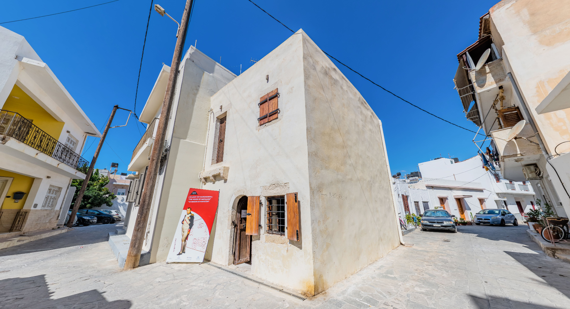
In the summer of 1798, tradition holds that Napoleon Bonaparte spent a night at the house of a prominent Ierapetra resident while en route to his Egyptian campaign.
Accounts from travelers mention significant antiquities, many now lost, some transported abroad during the Venetian period and now housed in museums across European cities, Istanbul, and Crete. Recent salvage excavations by the Ephorate of Antiquities of Lasithi have revealed important finds, primarily at "Vigla," just west of the modern city, identified as the center of the Roman city. Significant building remains, including an odeum, have come to light alongside notable portable artifacts. Additionally, the cemeteries of the city north of Vigla have been excavated in recent years.
The establishment of the Archaeological Collection began in the late 19th century by archaeology enthusiasts from Ierapetra. After enduring destruction and looting up to World War II and undergoing multiple relocations, the Collection was housed in 1986 in the Ottoman School building, also known as "Mehtepi," where it remains today.
The building, constructed in 1899, is designated as a modern historical monument. Its floor plan is an elongated rectangle with three nearly square sections protruding at each end and the center, where the three entrances are located. Architecturally, it features simple neoclassical elements combined with eclectic details, such as the decoration of the central entrance, Venetian-inspired motifs, and the stone cordone—a semicircular molding—that crowns the buttressed façade base.
The Collection has been enriched with objects from later discoveries and excavations conducted by the Ephorate of Antiquities, the British School at Athens, and the American School of Classical Studies at Athens in Ierapetra and its broader region. The exhibits span from the Minoan to the Roman period (3100 BC–324 AD).
In the first of the three halls, the exhibits date from 3000 BC to 324 AD, reflecting various aspects of life, including daily activities, religion, and death. From the settlement of Fournou Korifi at Myrtos, dating to the Early Minoan II period (2600–2200 BC), notable vessels and early pottery wheels are displayed. From the islet of Chrysi, two treasures uncovered in recent excavations are exhibited: the treasure of bronze talents and the treasure of jewelry. Other items from various areas in the Ierapetra province include stone vessels, tools, lamps, and a well-preserved stone mold for casting bronze axes.
From the settlement of the Late Minoan IIIC period (1200–1100 BC) at Vrontas, near the modern village of Kavousi, two impressive clay figurines of the Minoan "goddess with raised arms," a deity of nature, stand out alongside ritual vessels found in the settlement's sanctuary. Few figurines and plaques represent the Archaic period of Ierapetra, while rare and intriguing for the area are the Attic red-figure vases of the 5th and 4th centuries BC. Roman-period ceramics (1st–5th century AD) are mainly represented by lamps, small amphorae, and perfume containers.
The second hall focuses on burial customs from the Late Bronze Age and the Iron Age. Key exhibits include larnakes (clay coffins) from chamber tombs of the Late Minoan III period (1440–1050 BC) found in Episkopi, Gra Lygia, and Kentri. The famous larnax from Episkopi stands out, adorned with depictions of animals, hunting scenes, chariots, and other imagery. From the Iron Age, a tomb reconstruction from Vrontas Kavousi with cremations is notable.
In the third hall, sculptures that adorned public and private buildings of the city during the Imperial Roman era are displayed. Dominating the space is an exceptional-quality and well-preserved statue of Demeter or Persephone from the 2nd century AD. The most significant sculptures, found in the Vigla area—the center of ancient Hierapytna—include a portrait of Emperor Augustus (27 BC–14 AD), a headless statue of Artemis, a statue of a Nereid on a dolphin, and a headless female statue from the city's ancient theater. The Roman sculpture collection is completed with inscriptions and funerary steles from the Hellenistic and Roman periods. Among these, a notable artifact is the bilingual stele featuring the treaty of the Hierapytnian people with King Antigonus Doson of Macedonia and their agreement of equal rights with the Arcadians (3rd century BC).
Information on Ancient Hierapytna (Ierapetra)
The ancient coastal city of Hierapytna is partly overlapped by the modern city of Ierapetra. Ancient sources preserve other names for the city, such as Kyrva, Pytna, Kamiras, and Hierapolis.
The earliest finds in the area date back to the 5th century BC. By the 3rd century BC, Hierapytna formed treaties and alliances with other Cretan cities and external powers like Rhodes, Macedonia, and Pergamon. By the mid-2nd century BC, it expanded its territory, conquering and destroying Praisos around 145 BC. Land disputes with Itanos led to prolonged legal battles over the sanctuary of Dictaean Zeus and the islet of Leuke (modern Koufonisi), eventually involving the Romans as arbitrators. During the Hellenistic period, its strategic location established it as a significant local power.
Hierapytna, the last bastion of Cretan resistance against the Romans, fell in 67 BC. During Roman rule, the city flourished due to its location as a commercial port in the southeastern Mediterranean. According to sources, the city had two theaters, an amphitheater, temples, a "Naumachia" (a port where mock naval battles were staged), and an aqueduct. Luxurious public and private buildings, tombs, and high-quality sculptures attest to its prosperity.
A significant remnant of this period is the seaside late Roman–early Byzantine wall (4th–6th/7th century AD), which still stands on the city's western edge, stretching approximately 160 meters.
The city thrived during the early Byzantine period, serving as an episcopal seat from 343 AD. However, the Arab invasion of 824 AD marked the end of its prosperity. During the second Byzantine period, its importance diminished in favor of inland settlements. In the Venetian era, Ierapetra experienced relative decline, although the coastal fortress Castel di Gerapetra was built in the 13th century AD for southern defense. The city remained a local center, part of the Sitia district (Territorio di Settia).
In 1647, Ierapetra fell to the Ottomans. The fortress, renamed Kale, was preserved during Ottoman rule with several repairs and modifications.
In the summer of 1798, tradition holds that Napoleon Bonaparte spent a night at the house of a prominent Ierapetra resident while en route to his Egyptian campaign.
Accounts from travelers mention significant antiquities, many now lost, some transported abroad during the Venetian period and now housed in museums across European cities, Istanbul, and Crete. Recent salvage excavations by the Ephorate of Antiquities of Lasithi have revealed important finds, primarily at "Vigla," just west of the modern city, identified as the center of the Roman city. Significant building remains, including an odeum, have come to light alongside notable portable artifacts. Additionally, the cemeteries of the city north of Vigla have been excavated in recent years.
According to tradition, the great military leader Napoleon spent a night in this building in July 1798, during his campaign against the Mamluks in Egypt. It is said that Bonaparte asked a family to host him in their home without revealing his identity. When he left the next morning, he left a note disclosing who he was. Although this story has not been confirmed, the legend of Napoleon remains deeply ingrained in the city of Ierapetra.
The building is a two-story structure of vernacular architecture, located in the oldest district of Ierapetra, known as "Kato Mera." The original complex of buildings to which it belonged was much larger, but today significant portions have been replaced by modern constructions.
The building's architectural features suggest that it dates to the late 18th or early 19th century, though its initial construction could possibly date back to an earlier period.
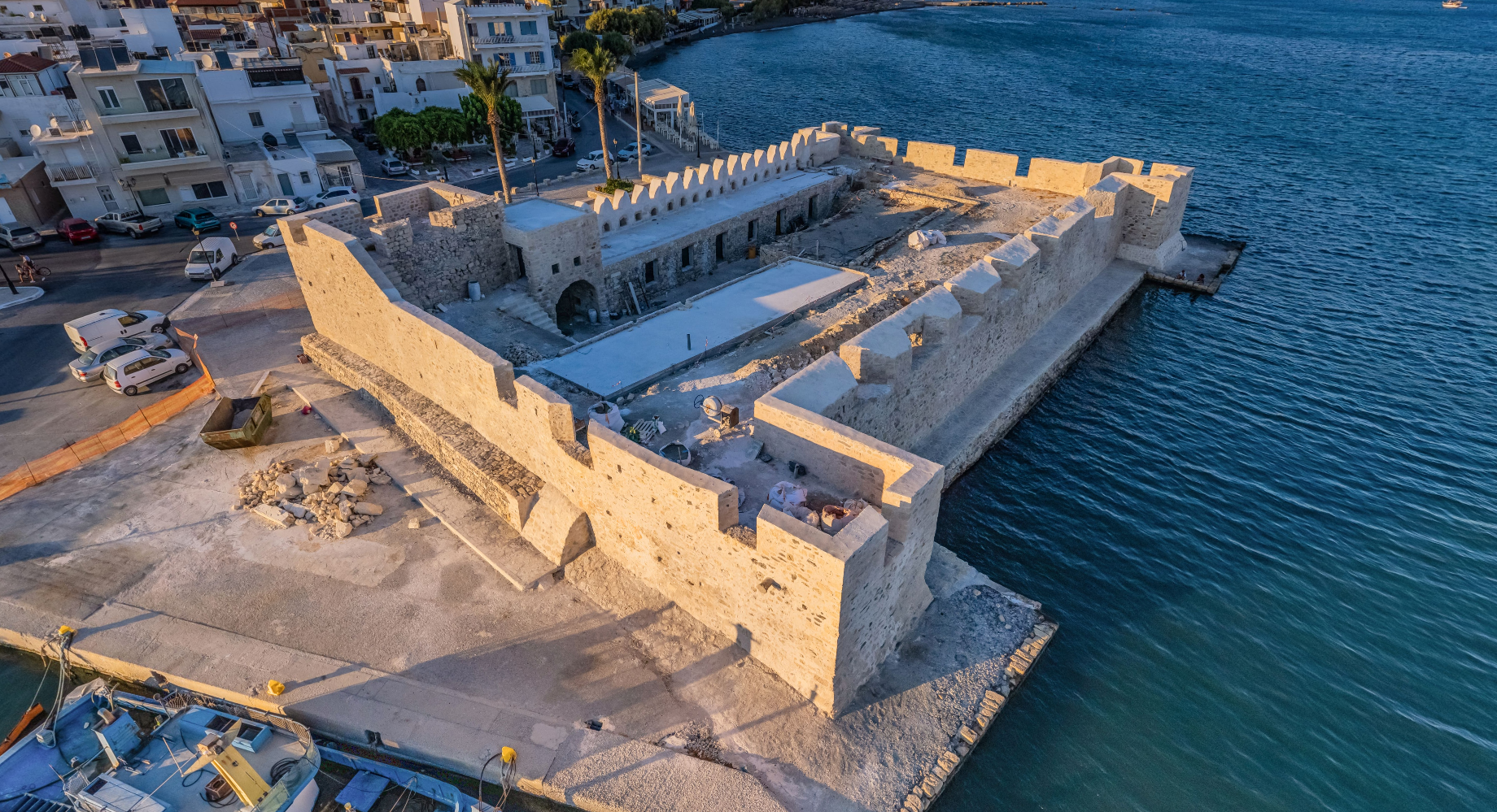
The Kales Fortress of Ierapetra occupies a central position along the city's coastal front and is a significant medieval monument of fortification architecture. It dates back to the 13th century and retains the main features of its original fortification design, with later modifications. The first written reference to the fortress appears in an official document of the Venetian Senate dated April 13, 1307, mentioning the construction (or repair) of the Castel di Gerapetra. It housed the garrison for the defense of Ierapetra and sheltered local residents during enemy raids and attacks. The fortress has a rectangular layout with four towers projecting from its corners. Inside, there is a long courtyard, on the eastern side of which a vaulted water cistern has been preserved. Originally, around the internal courtyard, barracks were arranged peripherally in contact with the four curtain walls (cortine) of the fortress, located below the level of the parapet walkway and Venetian battlements.
In 1508, the fortress suffered significant damage due to an earthquake and Ottoman raids. The damage was not fully repaired, possibly due to its severity and lack of financial resources. Extensive repairs were carried out in 1627 in response to the increasing Ottoman threat, aiming to adapt to changes in warfare tactics and the widespread use of cannons. The rooms on the eastern, southern, and western sides of the fortress, along with three of the four towers, were filled in, and the walls were reinforced. Gunports for cannons were added to the parapets of the upper level.
In 1647, Ierapetra fell to the Ottomans, who maintained the fortress for defensive purposes, making successive repairs, internal modifications, and adding the characteristic crenellated Ottoman battlements on its northern façade. During this period, the fortress retained the name Kales, which means "fortress" or "tower."
The Kales Fortress was one of the few older fortresses repaired by the Ottomans to be integrated into their defensive network established after the Cretan Revolution of 1866. This network was created under the direction of Hussein Avni Pasha in 1868, featuring a series of "fortified lines" with the construction of strongholds (koulédes) to disrupt communication between the Cretan revolutionaries. One of the main fortified lines extended along the isthmus from Pachia Ammos to Ierapetra, ending at the Kales Fortress.
After the union of Crete with Greece in 1913, the fortress housed the headquarters of the Gendarmerie and was later transferred to the Ministry of Finance. It suffered severe damage during World War II from bombings and later due to sea storms. Restoration work was carried out by the Ministry of Culture between 1975 and 1987, and foundation reinforcement was implemented around its perimeter in 2006–2007. Since 2019, extensive stabilization and restoration efforts have been ongoing.
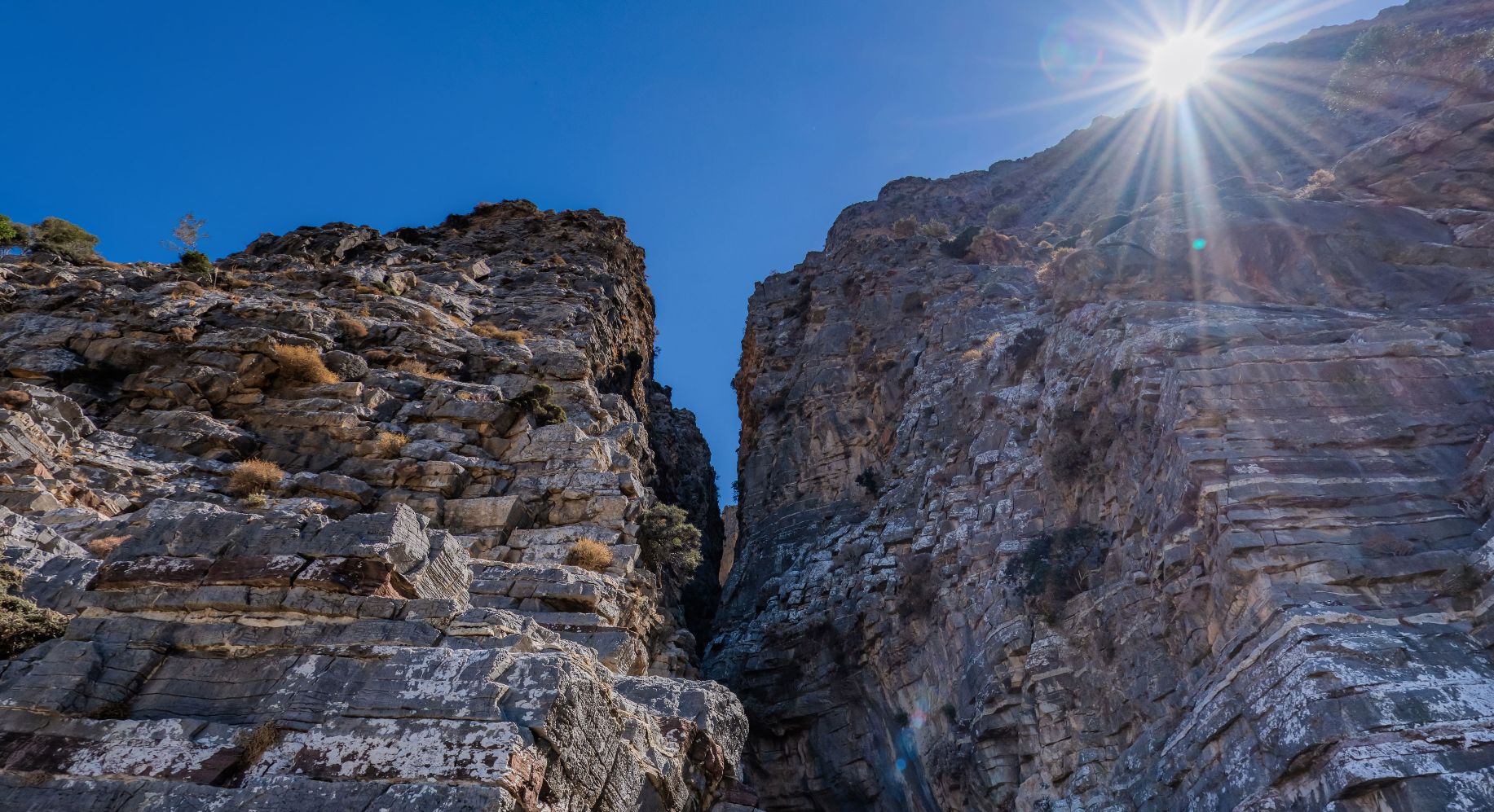
The Sarakina Gorge, also known as the Sarantapichos Gorge, is a natural landmark located in close proximity to the village of Mythi in the Municipality of Ierapetra. Its name comes from the conquering Saracens, who according to the locals had found a hideout in the area. Its second name has its roots in ancient Greek mythology, when the giant Sarantapichos bent down to drink water from the river and with his beard tore the mountain rock in two.
It is one of the smallest gorges in Crete, since its length does not exceed 1.5 km and it takes about 1 hour to cross it. Hiking in the gorge is a popular activity, with nature lovers following the circular path that starts from the village of Meskla. Carved steps, tree trunks and metal walkways make exploring the gorge a passable and safe experience.
The gorge owes its stunning beauty to the unique geological formations, created by the continuous flow of the river Kryopotamos. Natural stone domes, rich vegetation of cypress and plane trees, as well as beautiful waterfalls create a beautiful landscape of natural beauty.
Malles or Males is one of the largest traditional villages of Crete. It is located 28km from the city of Ierapetra and 40km from Agios Nikolaos. The beautiful head village has traditional villages, narrow winding streets and a peaceful atmosphere for those seeking a quiet retreat away from the busy coastal areas of Crete.
Known for its olive oil production and its vineyards, the Malles take their name from ancient Malla, an autonomous city-state with its own army, coins and cult deities. Later, during the Venetian period, they emerged as one of the largest villages in Crete.
Built at an altitude of 600 meters, the village offers the visitor a picturesque setting with views of the valley of Myrtos, the Libyan Sea and the surrounding mountain peaks. The impressive natural environment of the village offers opportunities for hiking and enjoyment of the countryside, with paths leading to nearby gorges and hills. From there one can explore various routes either to the pine forest of Selakanos, or to the Katharo plateau and the springs of Retiko.
Points of reference are the arched-roofed church of Panagia Mesochoritissa, which is located in the centre of the village, as well as the late Byzantine church of Agios Nikolaos, with an inscription of the 17th century.
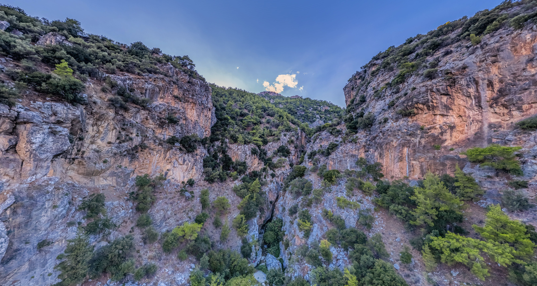
The Ha Gorge is formed on the western slope of Mount Trypti and is one of the wildest and most imposing gorges in Crete. Its particular name comes etymologically from the verb 'Hasko', which means to create a gap, an opening.
The gorge is nestled in a rugged landscape, surrounded by towering cliffs and wild vegetation. The steep walls rise to heights of 200 to 400 metres, creating a narrow and deep gorge that can be seen from afar. In many places it is only 30 centimetres wide and in others no more than 3 metres wide. Its total length is 1800 metres.
Its entrance is near the settlement of Kato Horio, Lassithi, and specifically under the Byzantine chapel of Agia Anna, at an altitude of about 480 m. The exit of the gorge is near the village of Monastiraki, at an altitude of 155 m.
Its impressive geological formation offers an amazing and adventurous hiking experience for nature lovers. The traverse requires appropriate equipment, technical knowledge and experience. Towards the end of the gorge, a large waterfall of 215 metres in height is formed, known as the 'Master'.
The city of Ierapetra, with a population of 13,000 inhabitants, is a favorite destination for visitors. The area of Ierapetra has been inhabited for more than three thousand years, and the ancient city of Ierapytna, a city of theaters and statues, reached its peak in the 2nd century BC where according to records its population reached 100,000 inhabitants making it powerful in Crete.
The city of Ierapetra is famous for its beaches. Apovathra is the most famous beach in the city, stretching in front of the historic fortress. Its waters are crystal clear and its sandy beach is covered with fine pebbles and sand. Here you can indulge in water sports and taste fresh fish and local food in the famous Gerapetri taverns! In addition to the pier, you will find very nice beaches in and just outside the city on its eastern side.
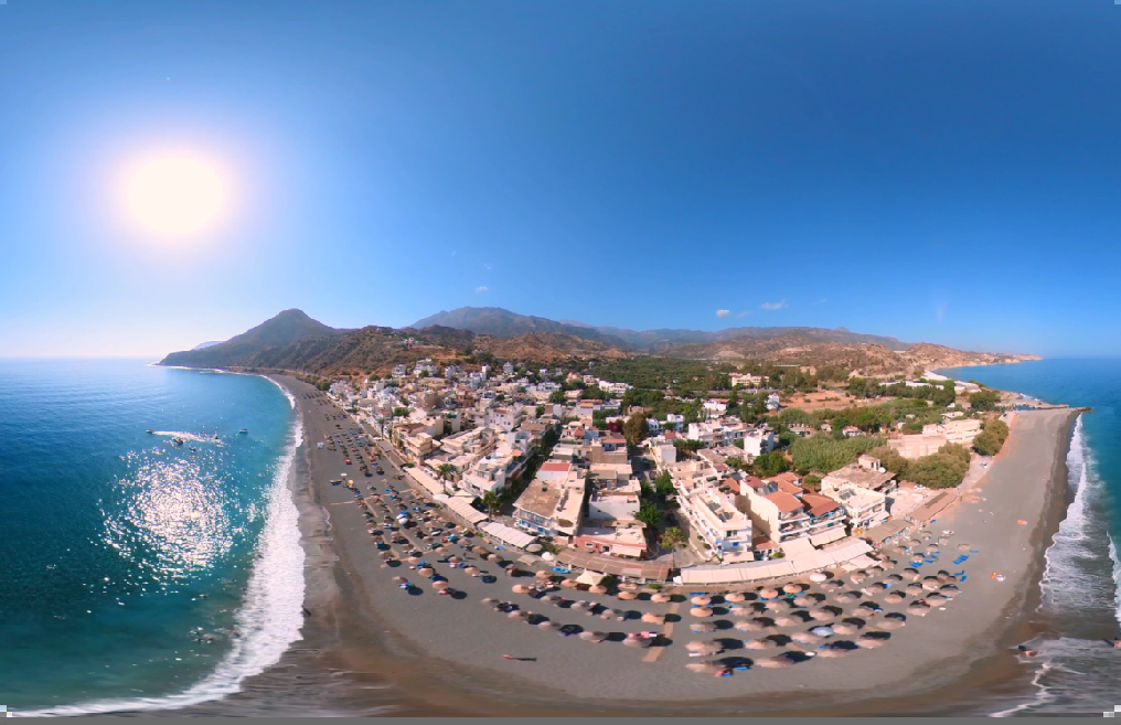
Makrigialos beach is a long sandy beach with shallow, crystal clear waters at a distance of about 25 km east of Ierapetra. The beach is known to locals as Hani or Megali Beach as it stretches for about 1.5km along the homonymous settlement. It is the village of Makrigialos, which is one of the most popular tourist resorts in the area, attracting visitors of all ages.
The beach is fully equipped with sunbeds, umbrellas, outdoor showers and services suitable for those who love water sports. The descent to the beach is gentle, with visitors passing through a large pedestrian walkway with many guesthouses, tavernas and bars nearby.
Thanks to its large area, even during peak tourist periods, Makrigialos beach offers a peaceful atmosphere to those who seek it. From there, one can follow a path and wander in the quiet nature. From the settlement of Makrigialos one can visit the Monastery of Kapsas, while in the wider area ruins of a Minoan mansion have been found, which dates back to the Late Minoan period (1550-1450 BC).
Tholos beach is located on the main axis connecting Agios Nikolaos with Sitia, 3.5km north of the village of Kavousi. It is a pristine beach, surrounded by ancient olive groves and vineyards, which makes it an ideal destination for those who want to enjoy a relaxing holiday.
The beach is characterized by strong winds and nearby there are many large tamarisks, which offer suitable shade to its visitors. It is a beautiful pebbly beach with milky waters and strong waves, which on its western side is sandy and more sheltered from the winds. The water is usually blue due to the underground freshwater springs from Mount Thripti.
Although better known to the locals of Kavousios, in recent years the beach of Tholos has experienced partial tourist development. Near the beach there are some accommodation and taverns, while the Messona Gorge and the copper mine at Chrysokaminos are also nearby.
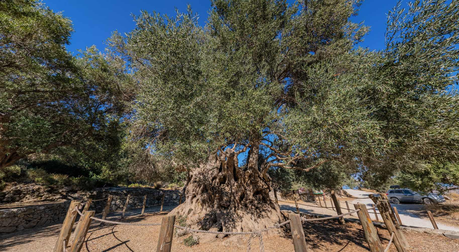
This impressive olive tree is located 1km south of the village of Kavousi, in the area of the archaeological site of Azoria. Known as "The Olive of Azoria", this tree is estimated to be one of the oldest olive trees in the world and has been declared a Monument by the Association of Municipalities of Crete. It symbolizes longevity, resilience and the rich agricultural history of the region.
Its trunk ranges from 4 to 7 metres and its girth reaches 22 metres at the base of the tree. These measurements allow a rough estimate of the age of the olive tree at about 3250 years, which marks its first appearance in the Post-Palatial Minoan period of Cretan history (1350-1100 BC). Points of interest near the Monumental Olive Tree include the archaeological sites of Azoria, Vrontas and Kastro.
The olive tree belonged in 2008 to Georgios Grammatikakis and is a variety of mastic or mulberry olive, grafted on wild olive. In 2004, following a proposal by the local residents and the municipality of Ierapetra, it was decided that the first winner of the Women's Marathon at the Athens Olympics would be crowned with a wreath from this olive tree.
Built along the southern road axis, 22 km from Ierapetra, is the coastal settlement of Koutsoura. In recent years, the settlement has experienced significant tourist development due to its natural beauty. At a distance of 1km is the homonymous pine forest with dense vegetation, which owes its name to the pine logs cut by the locals in order to cultivate them.
Starting from the pine forest, one can cross the Gorge of the Red Butterflies. It is named after the numerous red butterflies that have made their appearance through the bushes and flowers, creating a rare spectacle. Although the butterfly population has declined significantly due to the extensive damage the canyon suffered after the 1993 fire, the vegetation is still vigorous and visitors may be able to encounter the beautiful butterflies during the spring months.
The Red Butterflies Gorge is one of the most famous gorges of southeastern Crete, which starts from the small forest of Koutsouras and ends just before the settlement of Orinos. It is about 6km long and it takes about 3-4 hours to cross it. It is one of the most beautiful hiking trails on the island, which can be easily followed through the marked path. The gorge is a landscape of heavenly beauty with small waterfalls, ponds and lush vegetation.
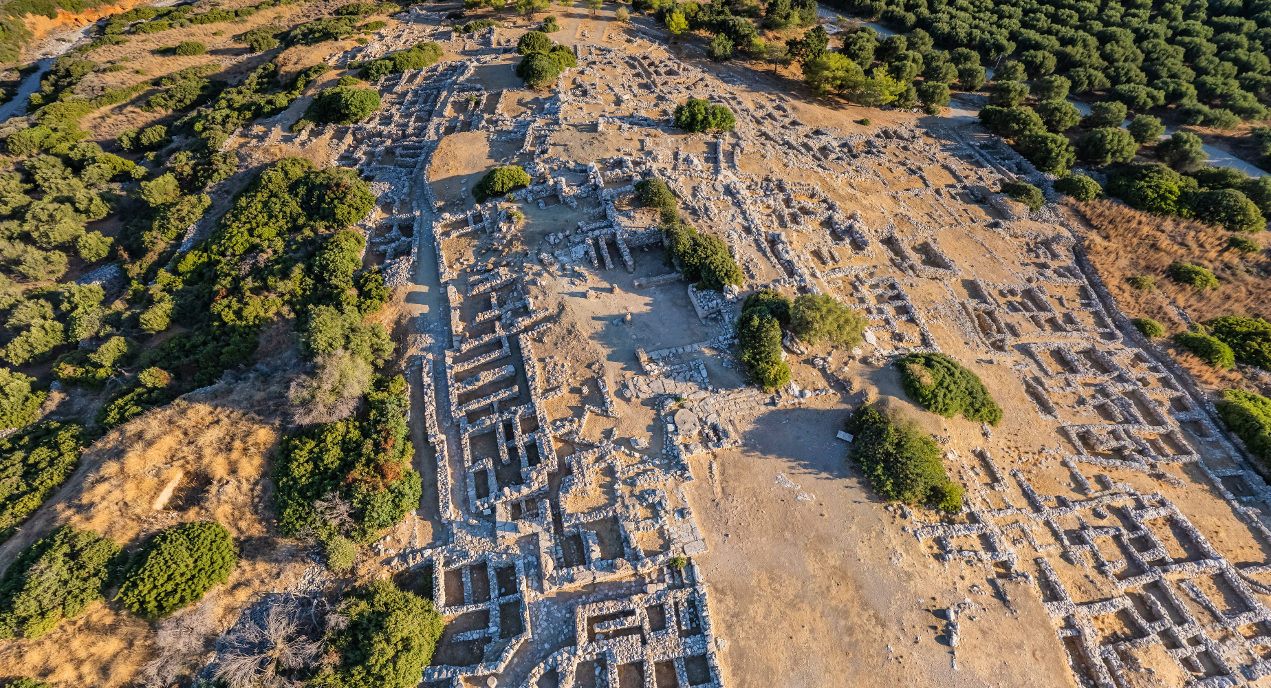
The city of Gournia is a characteristic example of a well-preserved coastal Minoan settlement.
The area was first inhabited during the Final Neolithic period (3600–3000 BC). Later, a settlement was organized on the hill and continued to develop. After destruction around 1700 BC, it was reorganized with the construction of a large public building and many new houses, reaching its peak between 1550–1450 BC. Shortly after its destruction in 1450 BC—similar to concurrent events at many centers in Crete—it was partially reoccupied and ultimately abandoned around 1200 BC.
The creation, development, and prosperity of the city are attributed to its strategic location on the Isthmus of Ierapetra, the narrowest part of Crete between the northern and southern coasts, as well as its proximity to the sea and areas suitable for agriculture and livestock farming.
The settlement spread across the slopes of a low hill. A system of roads, often stepped, defined building blocks. Another road led to the nearby port.
The houses are preserved at the level of their foundations, basements, or the lower stone-built sections of their ground floors, which were used as storage and workshop spaces. Some houses also had courtyards. The upper floors, which served as the main living areas, were accessed via external stone staircases and have not survived in any of the buildings.
The "palace," the seat of local administration, was built at the hill's summit. It shares several features with the larger Minoan palaces, such as storage rooms (one of which contained twelve pithoi arranged along the walls), a bath, a light well, and written records.
On the southern side of the "palace" lies a large rectangular courtyard—accessible via public roads—which likely served as the center of public life, a gathering place, and a venue for rituals with a religious character. A series of steps in a "Γ" shape (resembling a Greek "gamma") was constructed between the "palace" and the courtyard, forming a rudimentary "theatrical area."
North of the palace, a small public shrine, accessible via a dead-end stone-paved road, dates to the final phase of the settlement's habitation. This shrine consists of a single room with a bench on its southern side. Ritual objects, such as cylindrical offering vessels with multiple handles, were found alongside figurines of the "goddess with raised arms," likely placed on the bench.
The Minoan city of Gournia offers a clear picture of daily life for the Minoans, especially during the 15th century BC. The findings, including clay vessels and tools (chisels, hooks, hammers, etc.), demonstrate the residents' engagement in agriculture, livestock farming, fishing, pottery-making, metallurgy, and weaving. Imported items reveal their trade relationships within and beyond Crete, while some luxury goods indicate their prosperity.
At the northern edge of the settlement, a systematically organized area for ceramic production—a "potters' quarter"—has been identified. This area included facilities such as clay preparation tanks, pottery workshops, and numerous ceramic kilns, highlighting Gournia as a major center of ceramic production. Other findings from the same area suggest additional craft activities, such as the creation of stone and metal objects.
A little further south, in the so-called "Northern Cemetery," above-ground tomb-house structures and burials in rock shelters have been discovered.
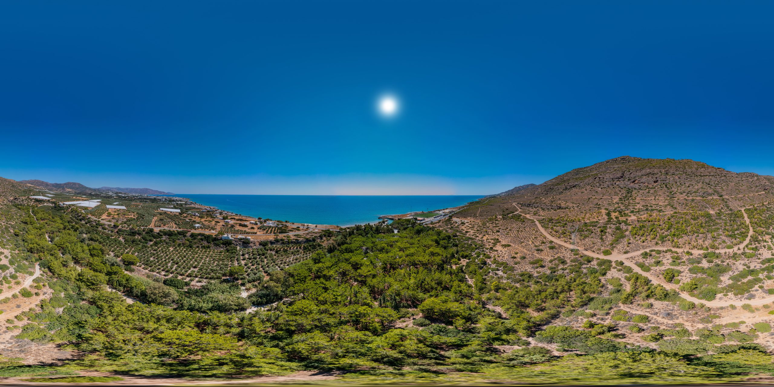
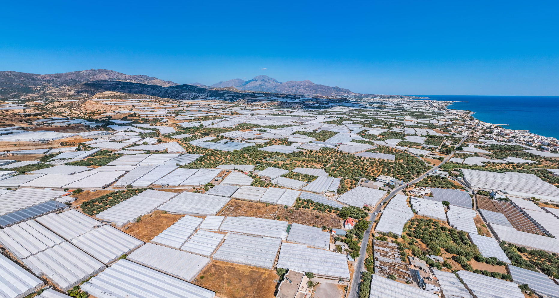
The history of greenhouse cultivation in Ierapetra dates back to the middle of the 20th century. Specifically, in the summer of 66, the Dutch agronomist Paul Cooper arrived in the region of Ierapetra, who was destined to bring the "revolution" in the field of agricultural crops. With the help of the farmer Apostolos Diakakis, Cooper built the first greenhouse made of wood and glass. Over the next twenty years, and despite the initial distrust of the locals, the area of Ierapetra was filled with greenhouses and the local economy was significantly strengthened. In the area of Gra-Lygia, among the greenhouses, there is a statue of Cooper, who died in a car accident in 1968.
Nowadays, the plain of Ierapetra has one of the most important greenhouse complexes, which spreads over an area of 17,000-20,000 acres from Pachia Ammos to Myrtos. The temperate climate and the farmers' know-how have made the region of Ierapetra a hub of agricultural innovation and a model of sustainable agricultural practices, with exports of agricultural products not only to Greece but also abroad.
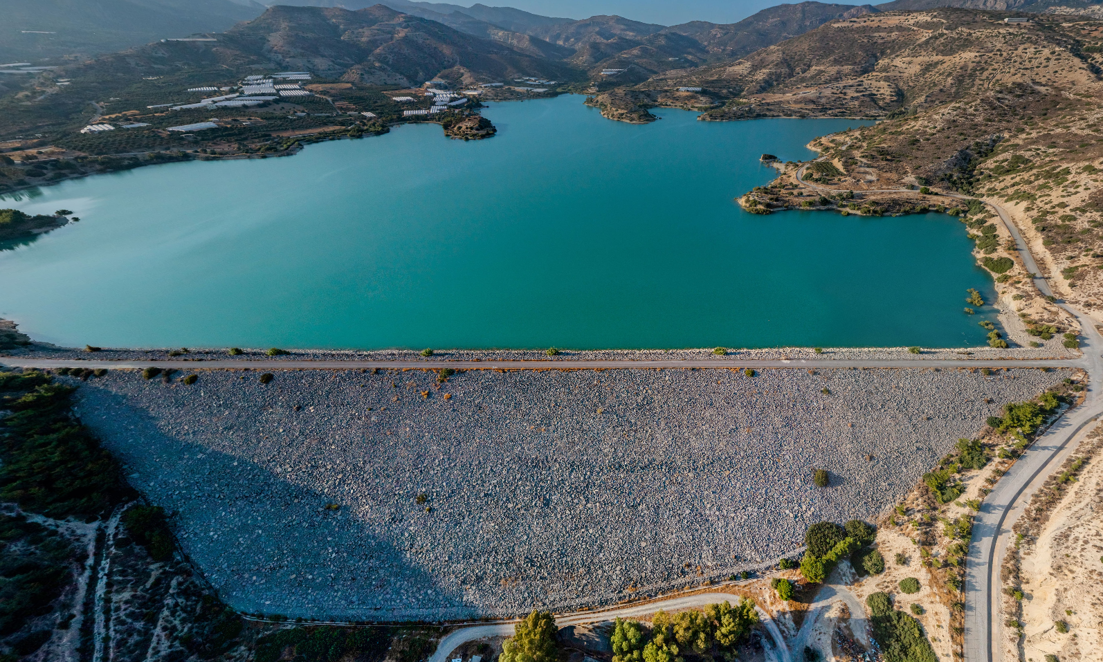
The Bramiana dam is one of the largest artificial lakes in Crete and one of the most important wetlands in Southern Greece. It is located 5km northwest of the town of Ierapetra, on the road to Kalamavka. It has a total surface area of about 1,050 hectares and can hold 15 million cubic metres of water. It was built in 1986 as part of a large water supply project to meet the cultivation needs of 30,000 hectares of the plain of Ierapetra.
The serene environment of the lake makes it an attractive destination for nature lovers and those seeking a quiet retreat in the Cretan countryside. Visitors can enjoy the magnificent scenery by taking a walk or cycling around the lake.
The lake has been designated a protected area, as it is an important ecosystem and one of the most important stations in Southern Europe for migratory birds. In total, over 218 different species of birds have been recorded, many of which can be easily observed through the constructed observatories.
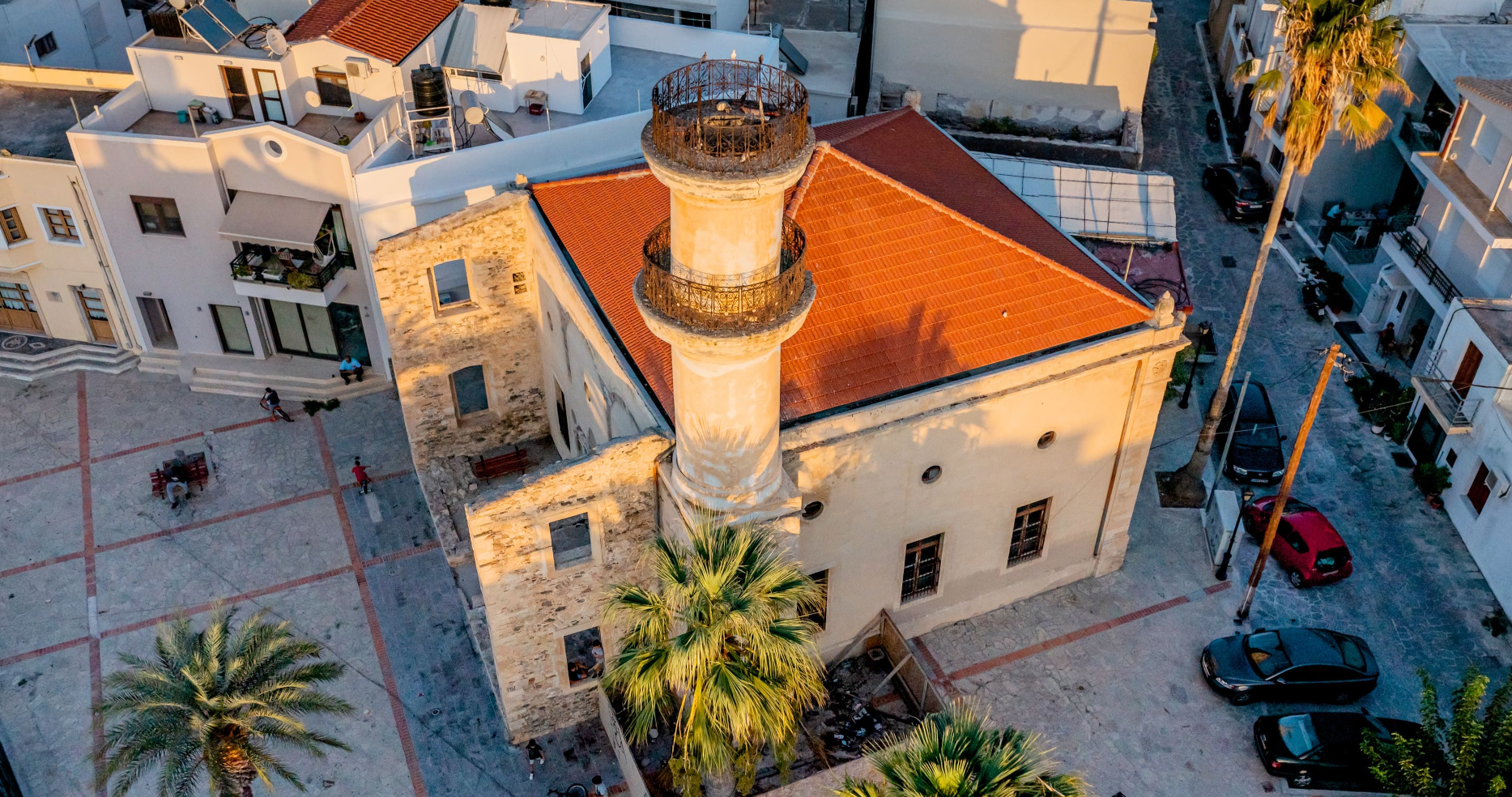
The mosque of Ierapetra is built in the old town (Kato Mera) at the end of the 19th century. According to the dates inscribed on the lintel of the entrance and the medallion of the south wall, it was built in the year 1309 (1871/1872), perhaps on the site of an older mosque. Its plan is square with a wooden, four-pitched roof with tiles. Neoclassical and eclectic tendencies characterize the architecture of the building, elements that were found in Crete during the last decades of the 19th century. On the north side there are traces of a narthex, open to the square. In the north-west corner of the mosque, as is customary, is the minaret, the upper part of which has been demolished due to the serious damage caused by an earthquake.
The mosque, together with the ornate fountain in the square on its western side, is a remarkable complex of Ottoman architecture in Crete. The fountain belongs to the category of sebil fountains and was a purification fountain before the worshippers entered the mosque. It has an octagonal plan with a dome and flame-shaped openings on each side. It is meticulously constructed of worked rectangular stones with fine relief decoration. The outflow holes on all sides as well as the water collection troughs are preserved.
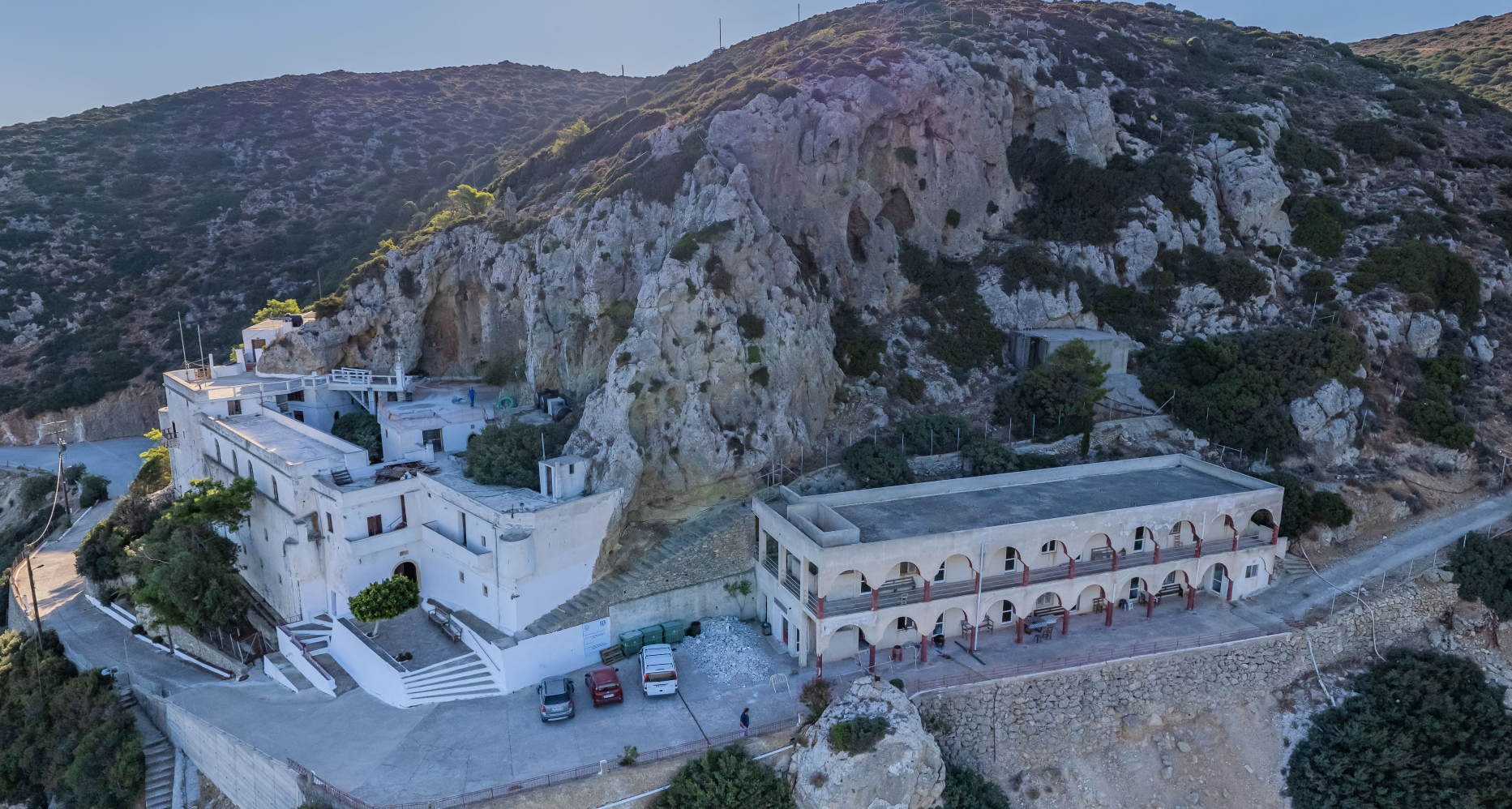
The Monastery of Faneromeni is an important pilgrimage site in Eastern Crete. It is a manly active monastery built in an inaccessible location, at an altitude of 540m on a particularly sloping, rocky terrain. It has a panoramic view of the entire bay of Merampelos.
The exact date of establishment of the Monastery is not known. According to some sources, in 1293, during the revolution of Alexios Kallergis, the leaders of the Cretan rebels gathered here to decide on the course of the struggle against the Venetian conquerors. This gives an indication of the existence of the monastery as early as the 2th Byzantine period (961-1204). The fortress-like building complex was developed during the Venetian period and continued to function during the Ottoman period.
The catholicon, dedicated to the Dormition of the Virgin and the Life-giving Spring, occupies the entrance of a cave that opens into a vertical rock, at the highest level of the complex. The facade of the catholicon is formed with architectural elements dating from the end of the 16th - beginning of the 17th century. The area of the temple communicates with an adjacent area of the cave where water drips and collects, which the faithful receive as sanctification. According to tradition, inside the cavernous church of the Catholic Church of the Monastery, the icon of the Virgin appeared to a shepherd, from where the Monastery got the name Panagia Faneromeni.
The floor plan of the monastery is approximately rectangular with general dimensions of about 49.5×24.5 m. while the complex consists of four units of buildings arranged around a narrow courtyard, with large differences in height. Its fortress-like character is indicated both by the enclosed exterior facades and by the sentries present at the outer corners.
During the 19thth century several repairs were made to the cells of the monastery, as the engraved dates, mainly on doors, testify. A wine press and a large built oven are housed in the ground floor wings, while the main vaulted tank is located under the churchyard.
Outside the main complex there are auxiliary buildings of various uses and the newest guest house of the monastery. Despite the modern interventions, the building complex of the Faneroi Monastery is undoubtedly an important example of Cretan monastic architecture.
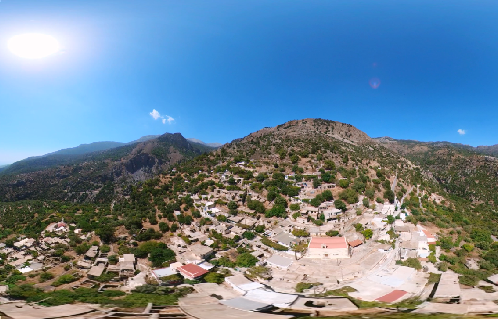
Agios Stefanos is a mountain village with 131 inhabitants and center of the homonymous community of the municipality of Ierapetra in the Lassithi Regional Unit of Crete. Together with the coastal settlement of Makry Gialos, they form the community of Agios Stefanos. It is located on the southern slopes of the Thryptis Mountains at an altitude of 453 meters. It is 30 kilometers from both Ierapetra and Sitia. Late Minoan vases have been found at Kalamokania. Traces of fortifications from the Geometric period have been found at Kastello or Fortetsa hill. In the location of Kato Vigli, a tombstone with a relief of a woman has been found. The village was mentioned by Francesco Barozzi in 1577 under the name Gras and was known as such until the beginning of the 20th century.
Agios Stefanos is a mountain village with 131 inhabitants and center of the homonymous community of the municipality of Ierapetra in the Lassithi Regional Unit of Crete. Together with the coastal settlement of Makry Gialos, they form the community of Agios Stefanos. It is located on the southern slopes of the Thryptis Mountains at an altitude of 453 meters. It is 30 kilometers from both Ierapetra and Sitia. Late Minoan vases have been found at Kalamokania. Traces of fortifications from the Geometric period have been found at Kastello or Fortetsa hill. In the location of Kato Vigli, a tombstone with a relief of a woman has been found. The village was mentioned by Francesco Barozzi in 1577 under the name Gras and was known as such until the beginning of the 20th century.
Makrigialos beach is a long sandy beach with shallow, crystal clear waters at a distance of about 25 km east of Ierapetra. The beach is known to locals as Hani or Megali Beach as it stretches for about 1.5km along the homonymous settlement. It is the village of Makrigialos, which is one of the most popular tourist resorts in the area, attracting visitors of all ages. The beach is fully equipped with sunbeds, umbrellas, outdoor showers and services suitable for those who love water sports. The descent to the beach is gentle, with visitors passing through a large pedestrian walkway with many guesthouses, tavernas and bars nearby. Thanks to its large area, even during peak tourist periods, Makrigialos beach offers a peaceful atmosphere to those who seek it. From there, one can follow a path and wander in the quiet nature. From the settlement of Makrigialos one can visit the Monastery of Kapsas, while in the wider area ruins of a Minoan mansion have been found, which dates back to the Late Minoan period (1550-1450 BC).
Makrigialos beach is a long sandy beach with shallow, crystal clear waters at a distance of about 25 km east of Ierapetra. The beach is known to locals as Hani or Megali Beach as it stretches for about 1.5km along the homonymous settlement. It is the village of Makrigialos, which is one of the most popular tourist resorts in the area, attracting visitors of all ages. The beach is fully equipped with sunbeds, umbrellas, outdoor showers and services suitable for those who love water sports. The descent to the beach is gentle, with visitors passing through a large pedestrian walkway with many guesthouses, tavernas and bars nearby. Thanks to its large area, even during peak tourist periods, Makrigialos beach offers a peaceful atmosphere to those who seek it. From there, one can follow a path and wander in the quiet nature. From the settlement of Makrigialos one can visit the Monastery of Kapsas, while in the wider area ruins of a Minoan mansion have been found, which dates back to the Late Minoan period (1550-1450 BC).
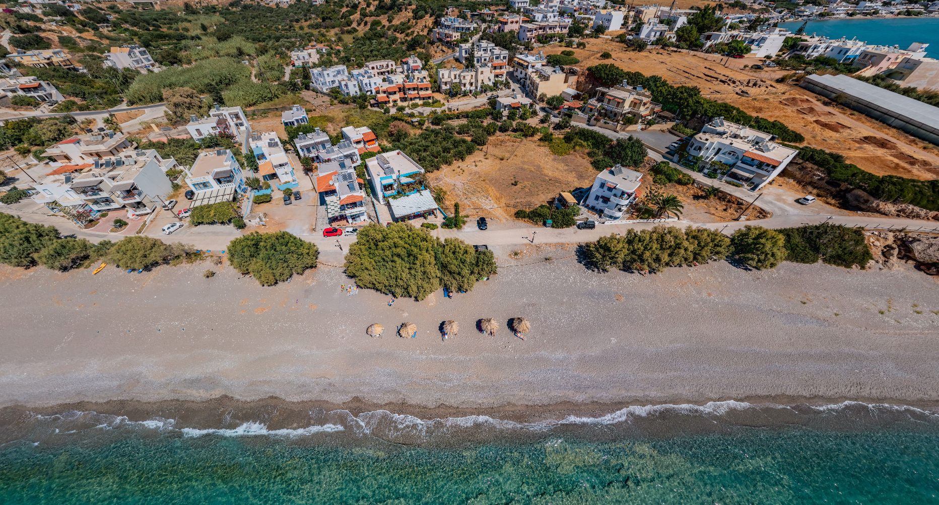
Megali Paralia is located 5 kilometers east of Ierapetra near the village of Koutsounari. It got its name because of its long length, which reaches 5 kilometers. The beach in its largest part is free, except for a small part with sunbeds, umbrellas and refreshments. It is characterized by its shallow waters and fine pebbles.
Megali Paralia is located 5 kilometers east of Ierapetra near the village of Koutsounari. It got its name because of its long length, which reaches 5 kilometers. The beach in its largest part is free, except for a small part with sunbeds, umbrellas and refreshments. It is characterized by its shallow waters and fine pebbles.
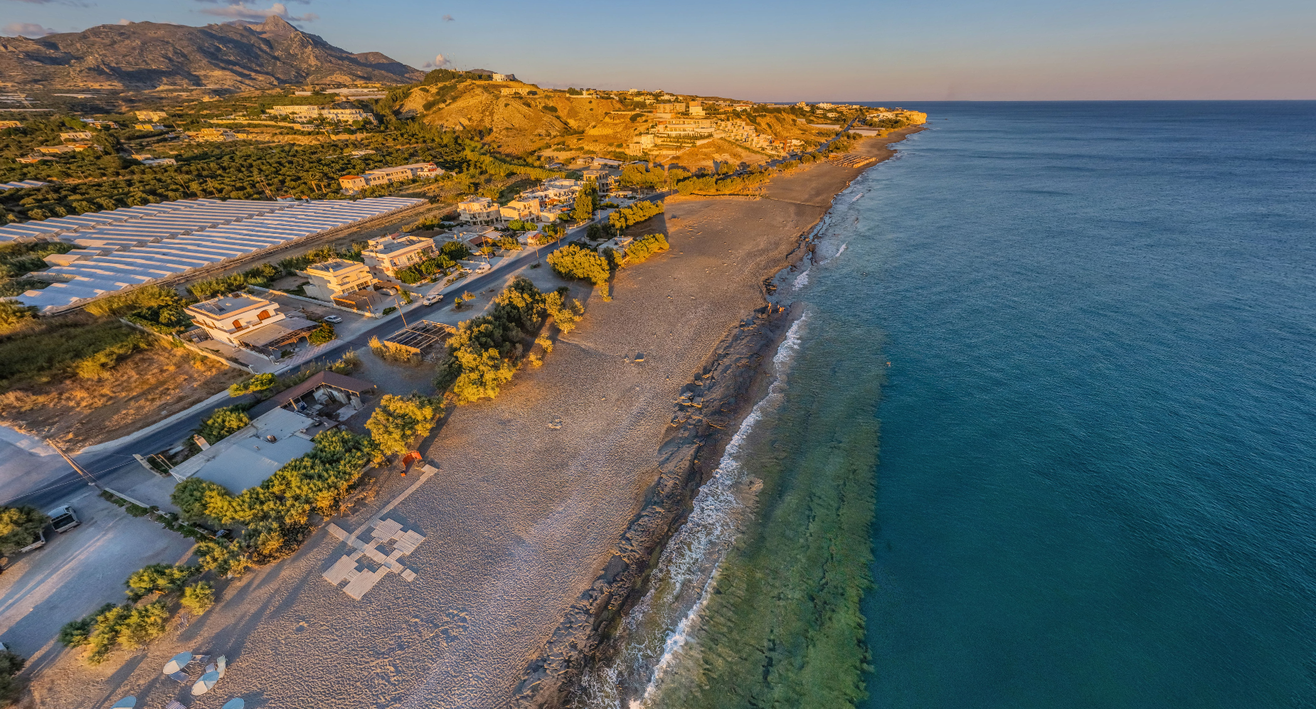
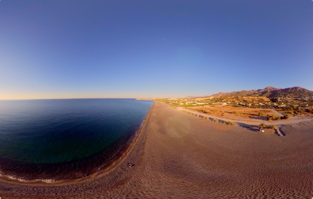
Myrtos is a village and seat of the homonymous community of the Municipality of Ierapetra in the Regional Unit of Lasithi. It is located on the provincial road of Ierapetra Viannos and is 14 kilometers from Ierapetra and 24 kilometers from Ano Viannos. It is built in an area overgrown with banana trees and close to the banks of the river Kryos. The beach of Myrtos, narrow and sandy, is fully organized with umbrellas, showers, changing rooms, lifeguards, and also has organized areas for water sports.
Myrtos is a village and seat of the homonymous community of the Municipality of Ierapetra in the Regional Unit of Lasithi. It is located on the provincial road of Ierapetra Viannos and is 14 kilometers from Ierapetra and 24 kilometers from Ano Viannos. It is built in an area overgrown with banana trees and close to the banks of the river Kryos. The beach of Myrtos, narrow and sandy, is fully organized with umbrellas, showers, changing rooms, lifeguards, and also has organized areas for water sports.
Selakano is a mountain settlement of the Community of Christos in the Municipality of Ierapetra, in eastern Crete. It is built at an altitude of 900 meters on the mountain of Diktis. It is 4 kilometers from Christos and 32 kilometers from Ierapetra. It is an area of natural beauty and its pine forest is one of the most important Natura 2000 ecosystems of the island.
Selakano is a mountain settlement of the Community of Christos in the Municipality of Ierapetra, in eastern Crete. It is built at an altitude of 900 meters on the mountain of Diktis. It is 4 kilometers from Christos and 32 kilometers from Ierapetra. It is an area of natural beauty and its pine forest is one of the most important Natura 2000 ecosystems of the island.
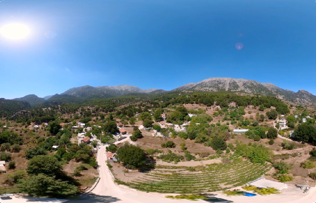
Christos is a village and seat of the homonymous community of the Municipality of Ierapetra, in eastern Crete. It is built at an altitude of 520 meters on the southeastern slopes of Diktis, at a distance of 28 kilometers from Ierapetra. To the west of Christos is the Selakanos plateau. Between Christos and Males, above the church of Agia Paraskevi, is the citadel of the ancient city of Mala. Arthur Evans identified remains of a Mycenaean fortification. Christ was probably created during the second Byzantine period.
Christos is a village and seat of the homonymous community of the Municipality of Ierapetra, in eastern Crete. It is built at an altitude of 520 meters on the southeastern slopes of Diktis, at a distance of 28 kilometers from Ierapetra. To the west of Christos is the Selakanos plateau. Between Christos and Males, above the church of Agia Paraskevi, is the citadel of the ancient city of Mala. Arthur Evans identified remains of a Mycenaean fortification. Christ was probably created during the second Byzantine period.

From the implementation of the project, new innovative digital services emerged and digital content was developed which is accessible from personal computers, tablets and smart phones, thus contributing to the satisfaction of the objectives set by the project:
• addressing the need to increase the Municipality's visitation and the attraction of new generation tourists,
• provision of new innovative e-services through the coupling of cultural goods and experiential tourism,
• utilization of the cultural resources and the promotion of the tourism product of the Islands through the use of innovative digital technologies and applications in accordance with the objectives of the P.E.P. of the South Aegean 2014-2020 and the National Digital Strategy 2021.
As part of the project, the following applications were made:
• A virtual tour application to selected points of interest of the Municipality, using virtual reality (VR) equipment
• Implementation of a Digital tour in the villages of the Municipality
• Interactive map application of the Library of Ierapetra
• Library visitors’ information application
• Virtual painting application for children
• Knowledge games for children based on the cultural heritage of the Municipality
• Knowledge game for children based on the content of the Ierapetra library
• Memory game for children based on the cultural heritage of the Municipality
• Memory game for children based on the contents of the Ierapetra library
Project Owner: Municipality of Ierapetra Contractors of the Project: TALENT INFORMATION S.A. / A.M.S. File Organization Systems Ltd.